
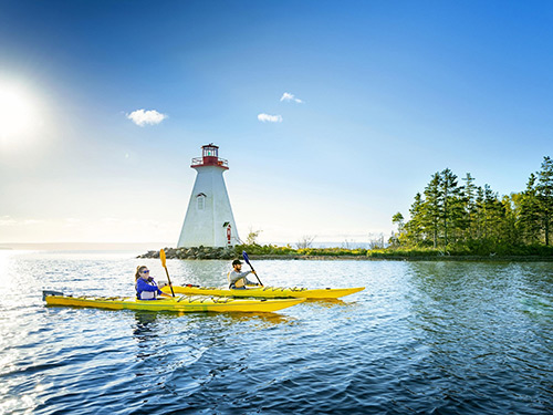
 Kayaking on the Pugwash River in Nova Scotia offers a serene and scenic experience, ideal for both beginners and seasoned paddlers. Here's a comprehensive guide to help you plan your adventure:
Kayaking Overview
- Ideal for All Skill Levels: The Pugwash River features calm waters, making it suitable for families and novice kayakers.
- Scenic Route: Paddling from the Wallace River to the Pugwash River provides a gentle journey through picturesque landscapes.
- Tidal Considerations: The best times to paddle are within three hours before or after high tide to ensure optimal water levels. (https://www.tides.gc.ca/en/stations/01775)
Access Points & Facilities
- Wallace Bay Wildlife Area: Offers a canoe and kayak ramp into both fresh and saltwater, providing easy access to the river. (see below)
- Friends of the Pugwash Estuary: This organization is developing facilities, including a barn for kayak storage and a launching area, to promote paddling activities. Friends of the Pugwash Estuary
Natural Highlights
- Pugwash River Estuary: Recognized as the largest estuary along Nova Scotia's Northumberland Strait shore, it boasts a mix of forest and marsh habitats, supporting diverse wildlife.
- Wildlife Watching: The estuary is a haven for waterfowl, including Canada geese and green-winged teal, offering excellent birdwatching opportunities. Nature Conservancy of Canada
Seasonal Events
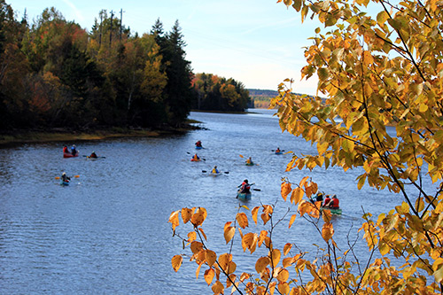
- Annual Flotillas: Community-organized paddling events, such as the fall flotilla, are popular traditions that attract numerous participants.
Additional Resources
- Pugwash Brochure & Map: For a detailed map and additional information about the area, refer to the official Pugwash brochure (PDF)
- Tourism Nova Scotia: Explore more kayaking and canoeing opportunities across the province. Places to Kayak and Canoe
Embarking on a kayaking trip along the Pugwash River promises a blend of tranquillity, natural beauty, and community spirit. Whether you're seeking a peaceful paddle or an engaging group event, the river offers something for every enthusiast.
 Access Points & Facilities – Pugwash River Area
-
Wallace Bay Wildlife Area
- Type: Public access ramp
- Features: Canoe/kayak launch into both freshwater and saltwater
- Facilities: Small parking area, basic interpretive signage
- Ideal for: Accessing the estuary and Wallace Bay National Wildlife Area
- Location: Near Route 6, ~10 km east of Pugwash
-
Pugwash Harbour – Wharf Area (Water Street)
- Type: Public dock / informal launch
- Features: Launch point for the Tidal Pugwash River
- Facilities: Village parking, nearby shops/cafés, seasonal public restrooms
- Notes: Be cautious of tides and boat traffic
-
Gulf Shore Road (near Dinghy Beach)
- Type: Shoreline/beach launch
- Features: Access to Northumberland Strait and estuary mouth
- Facilities: Informal, no built infrastructure; limited parking
- Best for: Experienced paddlers
-
Estuary Conservation Lands (Friends of the Pugwash Estuary)
- Type: Future formal launch site (in development)
- Features: Scenic estuarine entry point with conservation interpretation
- Planned facilities: Kayak barn, signage, marked trails
- More info: pugwashestuary.com
-
Salt Marsh Trailhead (Back Pugwash Road area)
- Type: Informal or seasonal launch
- Features: Access to protected marshland and birdwatching spots
- Facilities: Walking trail, interpretive panels
